“With AvoMap, we’ve added stunning 3D previews of our race courses — not just helpful for runners prepping before race day, but also a game-changer for our live briefings on-site. If you're a race organizer looking to give participants a clearer, more immersive course overview, we highly recommend it.”

Route Maps Made Simple
Create animated route maps with AvoMap. Draw the route or drop in a GPS file
— and share the trip as a 3D video.
Create a Cinematic Map Video
with AvoMap
- Design your Route
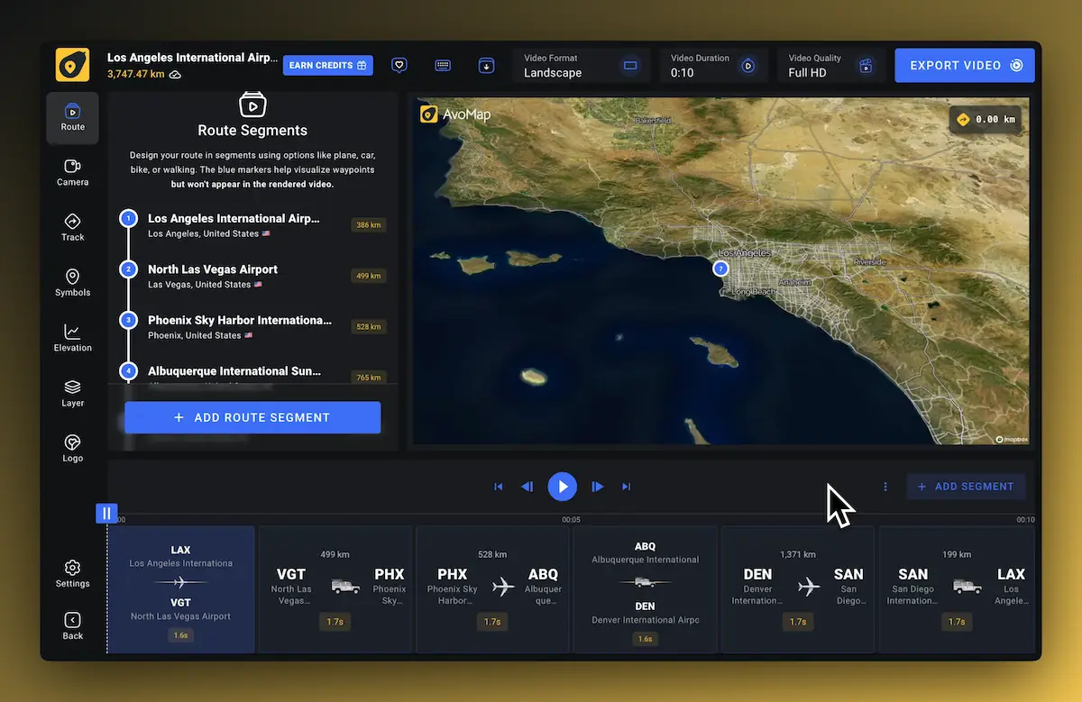
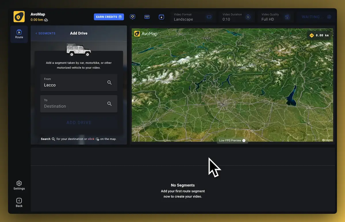
Start by uploading a GPX or KML file, or manually design a custom route using the AvoMap editor.
- Customize Your Route
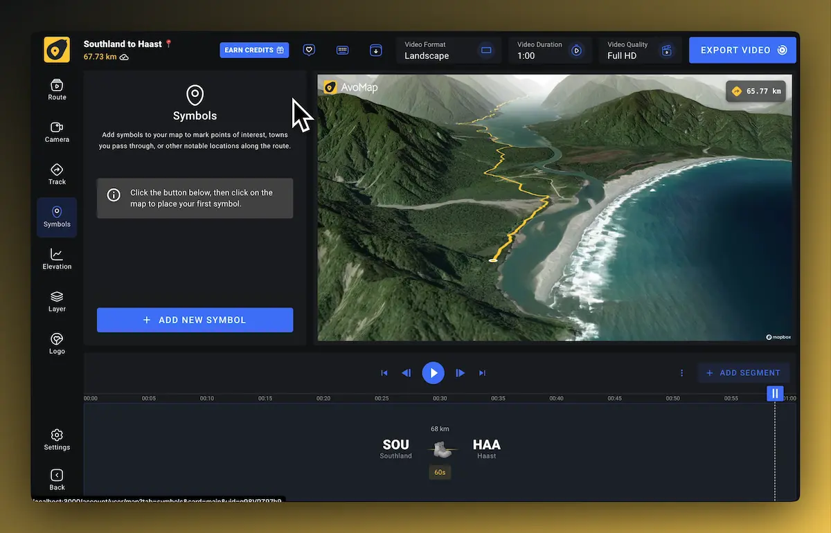
Edit the route by adding segments like drive, walk, or flight. You can also insert pauses, change altitude, pitch, and camera angles.
- Preview and Animate
AvoMap lets you preview your route animation in real time. Tweak the settings for smooth transitions, labels, and map styles.
- Export Your Video
Choose your resolution and render your route as a high-quality Full HD or 4K video. You can then download or share it online.

What's a Route Map, Really?
It’s more than just lines on a map — it’s your story in motion. AvoMap transforms your journey into an animated experience that’s as vivid as the adventure itself. Perfect for:
- Hiking & biking adventures
- Epic road trips
- Race or marathon replays
- Scenic delivery routes
- Tour planning

Fly Along Your Route
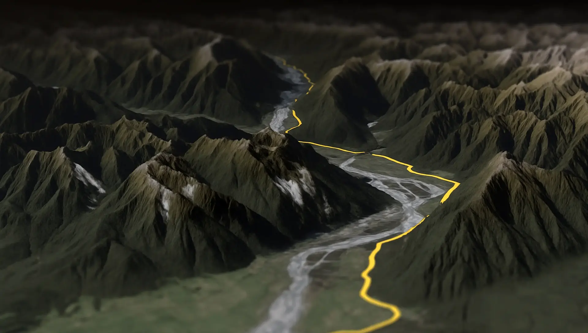
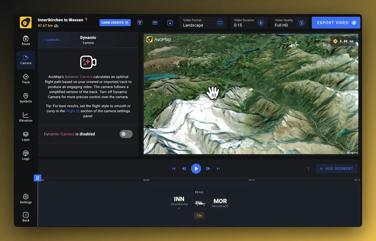
Enable Dynamic Camera to add smooth, aerial motion to your animation. It follows your route automatically, adjusting angles, pitch, and speed to match each segment — making your video feel natural, polished, and easy to follow.

Add Markers in seconds
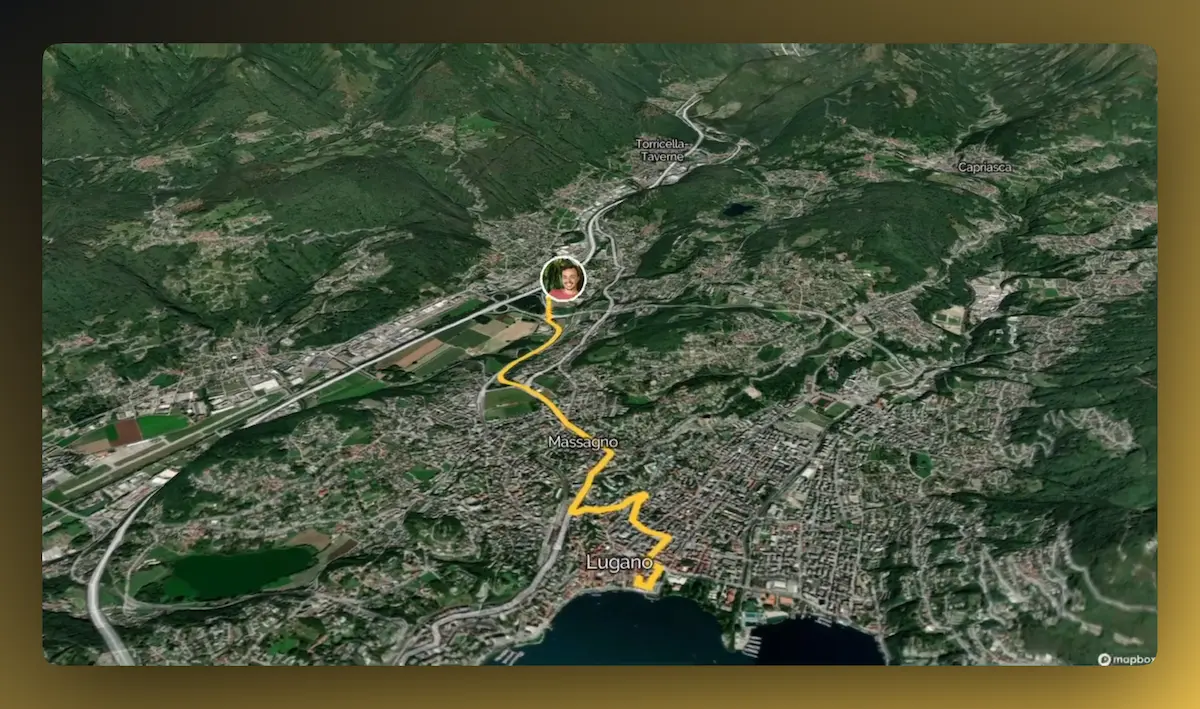
Marking important spots on your map is quick and simple. Just upload your GPX or KML file, and AvoMap will detect any waypoints automatically. You can also add markers manually wherever needed.
AvoMap includes over 100 built-in marker presets for common points of interest — such as trailheads, campsites, cities, viewpoints, and more. Select the one that fits, place it on the map, and add your own title or description to give context.

Join Thousands Of Happy Users
See what some of them have to say about AvoMap
“I run a YouTube channel focused on trail running. For our Live Race Briefings, AvoMap helps me present race maps exactly how I want. It’s the perfect tool to bring my ideas to life as a content creator.”
“Avomap is a fantastic tool with an incredible range of options for preparing a route in a unique and exciting way. This makes cross-country runs truly enjoyable!”
“I discovered AvoMap by chance when searching for a way to create a professional route map for a local 10K and Half Marathon event. Not only was I able to display the route in a polished video, but I was also able to add notable markers, and display the elevation on screen. My client is delighted, and I'll definitely use the service again in the future.”
“I have searched through a number of tools on the Internet to be able to visualize the routes of my road trips and vacations. None of the tools are as good as AvoMap, and it is improved almost weekly. You can really see the attention to detail in every feature.”
“An extremely user-friendly and intuitive tool, and of highest quality mapping and imaging I've seen! I use it regularly to visualise my hikes and treks in many videos I produce for my YouTube channel. It is a tool that meets all of my YouTube channel's needs.”
“Work has taken me all over the world and ignited my interest in documenting my travels. AvoMap provides me a beautiful way to see my journey and remind me of the many beautiful places I have seen.”
“AvoMap was incredibly easy to use — the learning curve was almost non-existent. Within minutes, I understood how everything worked, and just a bit later, I had a beautiful map video ready to go.”
“AvoMap is the perfect tool for promoting our trail races in Tây Giang, in the highlands of Vietnam. The videos bring our routes to life and help attract more runners to the region. Super easy to use and effective!”
“I’ve always enjoyed using tools like Felt.com to plan and mark up my trips — but I wanted something more immersive. AvoMap delivers exactly that, with stunning 3D maps and smooth animations that bring my journeys to life.”
“AvoMap has been a game-changer for my YouTube channel! It's easy to use, delivers high-quality videos fast, and offers great customization. Whether uploading GPS files or creating routes from scratch, it's the perfect tool for content creators — no tech skills needed.”
“I’ve been using AvoMap since 2024 to document my bikepacking journeys and create YouTube videos. The editing tools are the best I’ve found for customizing the fly-throughs I want to share, and the 4K render quality is beautiful. Plus, the AvoMap team is incredibly responsive to support questions and open to new ideas.”
Why Use AvoMap?
Turn your routes into cinematic stories — no installs, no complexity.
- Works with Your Data
Supports GPX, KML, or freehand route creation to suit every type of journey.
- Smart Segments
Set custom behavior per segment: drive, fly, walk, or pause — for true-to-life motion.
- Design Freedom
Pick colors, map styles, camera angles, and timing to match your story.
- Super Fast Rendering
Export your animation in HD or 4K in just a few minutes.
- Social-Ready
Get output formats optimized for Instagram, YouTube, and more.
- Made for Travelers
Visualize your full itinerary or share daily legs of your trip with ease.
- No Install Needed
AvoMap runs entirely in your browser — no downloads, no plugins, no hassle.

We have added full 3D course previews with AvoMap, which are useful not only for runners before our races but also for our live race briefings at the event. We recommend AvoMap to fellow race organizers who want to provide better course information to their participants.


Import your GPS data from top brands
AvoMap works seamlessly with all your favorite platforms. Just export your adventures and bring them to life with stunning animations in seconds.
Frequently Asked Questions
What file types can I use?
We support GPX, KML, or manual route creation with our map editor.
Is video editing experience required?
Nope! Everything is done in your browser.
Can I combine walking, flying, and driving in one video?
Yes! AvoMap supports mixed-mode animations. You can switch between walk, drive, fly, or pause for each segment of your journey — all in one smooth video.
Do I need a GPS file to get started?
Nope. You can draw your route manually on the map if you don’t have a GPX or KML file. It’s fast, intuitive, and gives you full control.
Can I pause the animation at specific points?
Absolutely. Add pauses anywhere along your route to highlight key locations or give viewers a moment to absorb the view.
What’s the difference between AvoMap and traditional route planners?
Traditional route tools show static lines on a map. AvoMap plays your journey back over real terrain with motion, elevation, and cinematic storytelling — like a drone shot of your route.
How long does it take to render a video?
Most videos are ready within a few minutes. Even 4K videos render quickly thanks to our optimized cloud-based pipeline.
Is there a watermark on the final video?
No watermark is added when you export a video with credits. You fully own the result — no branding or logos. This upgrade costs just two additional render credits.
Can I add music or voiceover?
Not directly inside AvoMap (yet), but you can import your video into any video editor like iMovie, Premiere, or CapCut to add music, narration, or effects.
Do you support multi-day trips or multiple maps in one video?
Yes. You can chain segments together for multi-day journeys and even insert pauses between days to keep things organized.
Videos Made With AvoMap
Explore the full range of AvoMap features in action with these videos, all created using the easy-to-use editor.
Splügen Pass to Italy 🇮🇹
The Splügen Pass connects Switzerland and Italy, linking Splügen with Chiavenna. At 2,113 meters (6,929 feet), it provides a direct route through the Alps, offering impressive views of the surrounding mountains and valleys.
Ride Through The Desert — Chile
Taking a motorcycle trip through the Chilean desert, starting from Combarbala and heading to La Serena on the coast.
UTMB Eiger Ultra 2024
With a distance of 101 km and an elevation gain of 6,700 meters, the Eiger Ultra 101 is a tough challenge for even the most seasoned trail runners. The route includes stunning viewpoints such as Grosse Scheidegg, First, Bachalpsee, Berghotel Faulhorn, Schynige Platte, Wengen, Männlichen, and the base of the legendary Eiger North Face.
Otter Trail — South Africa
The Otter Trail is a five-day hiking route in South Africa, starting at Storms River Mouth Rest Camp and finishing at the small resort village of Natures Valley in the de Vasselot section of the park.
Kepler Track — New Zealand
The Kepler Track is one of New Zealand's Great Walks, renowned for its stunning natural beauty and varied landscapes. It's a 60-kilometer (37-mile) circular hiking trail located in Fiordland National Park on the South Island of New Zealand. The track typically takes around 3 to 4 days to complete and passes through diverse terrain, including beech forests, alpine meadows, and alongside pristine lakes and rivers.
170 Miles Around Lake Tahoe
The Tahoe Rim Trail is a 170-mile long hiking path encircling the Lake Tahoe Basin in the Sierra Nevada, traversing parts of Nevada and California in the United States. It spans elevations from 6,223 feet at Lake Tahoe's outlet to 10,338 feet at Nevada's Relay Peak.
The Grand Raid — La Reunion
The Grand Raid de la Réunion, known as La diagonale des fous, is an ultramarathon held annually in October on Réunion island, a French overseas department located in the Indian Ocean between Madagascar and Mauritius.
Frankfurt To Dubai In 30 Seconds
As a break from my usual routine, I decided to embark on an epic journey by motorbike from Frankfurt to Dubai. It took me 62 days to complete the trip, and along the way I crossed through 11 different countries including France, Switzerland, Italy, Greece, Albania, North Macedonia, Bulgaria, Turkey, Georgia, Armenia and Iran.
Zugspitze Ultra — Germany
The Zugspitz Ultratrail stands as Germany's premier trail running event. Drawing over 4400 participants, it features six distinct routes spanning from 16 to 106 kilometers in length.
San Francisco Marathon
The San Francisco Marathon is a renowned race featuring a full marathon, half marathon, and 5K. Held in late July, it navigates iconic landmarks like the Golden Gate Bridge and Fisherman's Wharf. The hilly terrain presents a challenge, but the stunning views and community support make it memorable.