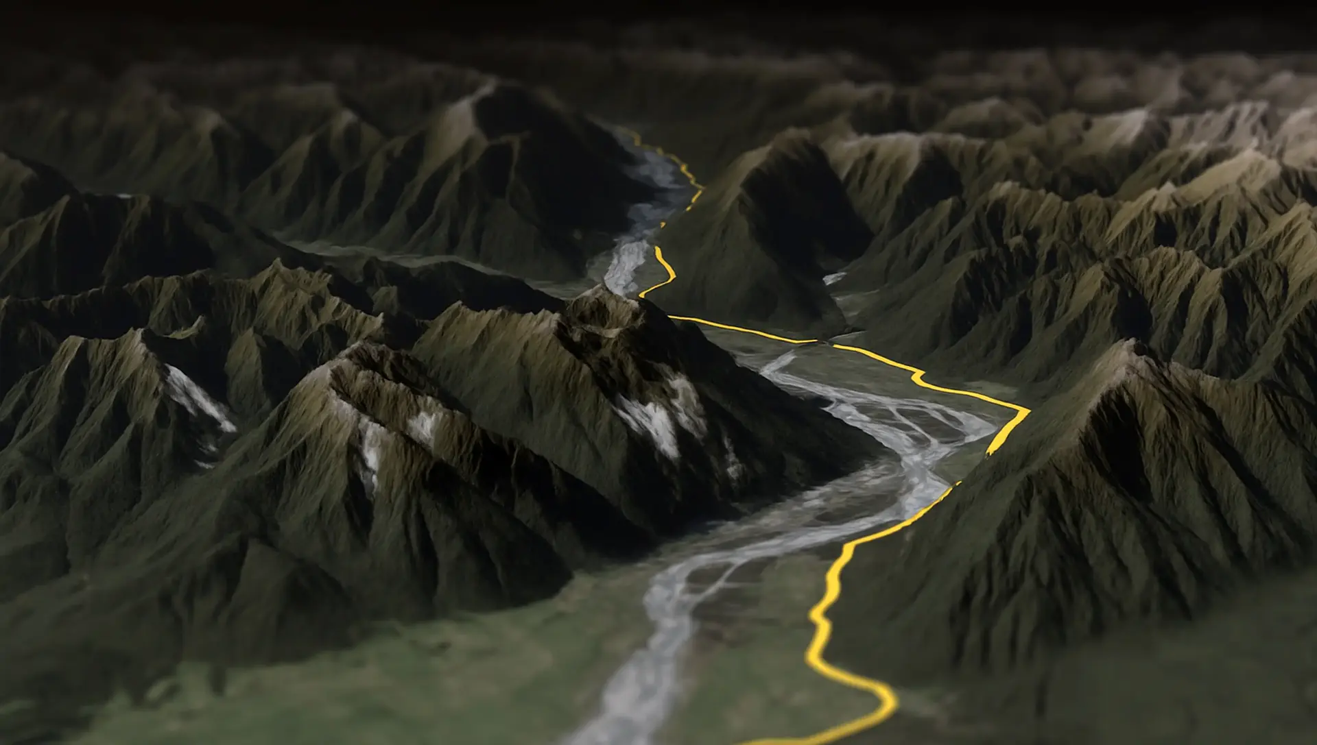
Splügen Pass to Italy 🇮🇹
The Splügen Pass connects Switzerland and Italy, linking Splügen with Chiavenna. At 2,113 meters (6,929 feet), it provides a direct route through the Alps, offering impressive views of the surrounding mountains and valleys.
Turn a KMZ into a shapefile
without sending it anywhere.
Drop the .kmz here. It is unzipped in this tab, the KML inside is read, and you get a zip with .shp, .shx, .dbf and .prj for QGIS or ArcGIS.
Want to look at the route first? The 3D preview is one click, and optional.
 Free onlineKMZ to SHP
Four steps, and the unzipping is done for you.
This page. No account, nothing to install.
Drag a .kmz onto the page, or click Select KMZ File. The archive is unpacked on your computer, not on a server.
You get the outline, the length and the number of features. If that looks wrong, load another file.
Click Download SHP File. A zip lands in your downloads with one shapefile per geometry type in the KMZ.
A KMZ is a KML file zipped up, usually with the icons and images it refers to packed alongside. Google Earth saves as KMZ by default because the result is smaller and travels as one file. Rename one to .zip and open it and you'll find a doc.kml inside. The converter does that unpacking, then reads the KML the same way the KML to SHP page does.
Images and ground overlays in the archive are ignored. A shapefile has no way to hold them.
The Esri format most GIS software reads natively. It is a set of files that belong together: .shp for the geometry, .shx as an index, .dbf as a table with one row of attributes per shape, and .prj for the coordinate system. The download here is a zip with all four, in WGS84, the same lat/lon the KML used.
One shapefile holds one geometry type. If the KMZ has pins and a path you get two shapefiles in the zip, one for points and one for lines. Placemark names and descriptions become columns in the .dbf, with names cut to ten characters.
The rows that explain most of what looks different after the conversion.
| Feature | KMZ | Shapefile |
|---|---|---|
| Files | One .kmz, a zip with a KML and media inside | .shp + .shx + .dbf + .prj |
| Format | Zipped XML | Binary geometry plus a dBase table |
| Geometry per file | Any mix of points, lines, polygons | One type per file |
| Attributes | Name, description, ExtendedData | Columns in the .dbf, names up to 10 characters |
| Images and overlays | Packed in the archive | Not supported, dropped |
| Coordinate system | Always WGS84 | Anything, declared in the .prj |
| Typical software | Google Earth | QGIS, ArcGIS, GeoPandas |
Same idea on every page: the file is read in your browser and nothing is uploaded unless you open the 3D preview.
KML in, GPX out, in your browser.
KMZ in, GPX out, in your browser.
GPX in, KML out, in your browser.
GPX in, KMZ out, in your browser.
KMZ in, KML out, in your browser.
KML in, KMZ out, in your browser.
KML in, a zipped shapefile out, for QGIS and ArcGIS.
Drop a zipped shapefile, get a KML for Google Earth.
Open a GPX and see the track, its length and where it starts and ends.
Open a KML or KMZ and see what is inside before you use it elsewhere.
Unzip a KMZ in the browser and see the paths and placemarks it holds.
Open a GeoJSON file and see its features drawn and measured.
Open a Garmin, Wahoo or COROS .fit file, see the ride or run, and download it as GPX.
Google Earth can fly a tour along a KMZ path. The AvoMap editor does that with satellite terrain and a camera you control, and exports the result as an MP4 in up to 4K.
The editor is free to use. You pay per exported video.
Explore the full range of AvoMap features in action with these videos, all created using the easy-to-use editor.
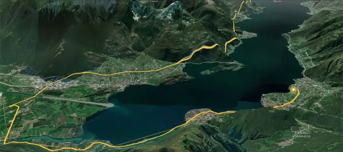
The Splügen Pass connects Switzerland and Italy, linking Splügen with Chiavenna. At 2,113 meters (6,929 feet), it provides a direct route through the Alps, offering impressive views of the surrounding mountains and valleys.
Taking a motorcycle trip through the Chilean desert, starting from Combarbala and heading to La Serena on the coast.
With a distance of 101 km and an elevation gain of 6,700 meters, the Eiger Ultra 101 is a tough challenge for even the most seasoned trail runners. The route includes stunning viewpoints such as Grosse Scheidegg, First, Bachalpsee, Berghotel Faulhorn, Schynige Platte, Wengen, Männlichen, and the base of the legendary Eiger North Face.
The Otter Trail is a five-day hiking route in South Africa, starting at Storms River Mouth Rest Camp and finishing at the small resort village of Natures Valley in the de Vasselot section of the park.
The Kepler Track is one of New Zealand's Great Walks, renowned for its stunning natural beauty and varied landscapes. It's a 60-kilometer (37-mile) circular hiking trail located in Fiordland National Park on the South Island of New Zealand. The track typically takes around 3 to 4 days to complete and passes through diverse terrain, including beech forests, alpine meadows, and alongside pristine lakes and rivers.
The Tahoe Rim Trail is a 170-mile long hiking path encircling the Lake Tahoe Basin in the Sierra Nevada, traversing parts of Nevada and California in the United States. It spans elevations from 6,223 feet at Lake Tahoe's outlet to 10,338 feet at Nevada's Relay Peak.
The Grand Raid de la Réunion, known as La diagonale des fous, is an ultramarathon held annually in October on Réunion island, a French overseas department located in the Indian Ocean between Madagascar and Mauritius.
As a break from my usual routine, I decided to embark on an epic journey by motorbike from Frankfurt to Dubai. It took me 62 days to complete the trip, and along the way I crossed through 11 different countries including France, Switzerland, Italy, Greece, Albania, North Macedonia, Bulgaria, Turkey, Georgia, Armenia and Iran.
The Zugspitz Ultratrail stands as Germany's premier trail running event. Drawing over 4400 participants, it features six distinct routes spanning from 16 to 106 kilometers in length.
The San Francisco Marathon is a renowned race featuring a full marathon, half marathon, and 5K. Held in late July, it navigates iconic landmarks like the Golden Gate Bridge and Fisherman's Wharf. The hilly terrain presents a challenge, but the stunning views and community support make it memorable.
Yes. Converting, the stats and the 3D preview cost nothing. AvoMap charges for exported videos, and that pays for the free tools.
No. The KMZ is unzipped, parsed and rewritten as a shapefile in your browser. Two things do leave the tab: the first and last coordinate, to look up the place names you see, and the route itself if you click Open 3D Preview. Skip the preview and the data stays put.
The first .kml found in the archive, which is doc.kml for anything Google Earth wrote. If you built the KMZ by hand with several KMLs, unzip it and convert each one on the KML to SHP page.
A shapefile holds one geometry type. If your KMZ has placemarks and a path, you get one file ending in -points.shp and one in -lines.shp. Add them as separate layers.
They're dropped, along with icons, colours and ground overlays. Shapefiles carry geometry and attributes, not media. The placemark names and descriptions do come through as columns.
WGS84, EPSG:4326, in decimal degrees. That is what KML uses, and the .prj in the zip says so. Reproject in your GIS if you need UTM or a national grid.
Yes. The converter tries KMZ first and falls back to KML. The KML to SHP page in the footer is the same tool with the other name on the door.
None enforced. Everything happens in memory on your machine. A KMZ that unpacks to several hundred megabytes will be slow on a phone and fine on a laptop.